Address

Oulanka Research Station
Liikasenvaarantie 134
93900 Kuusamo
Finland

Station manager

Riku Paavola

Contact Station

E-mail: oulanka@oulu.fi

www.oulu.fi/oulankaresearchstation

Station Features

Opening year: 1966 Status: Open
  • Type of station: Station
  • Operational period – year-round or Month A to Month B: Year-round
  • Name of station owner: University of Oulu
  • Type of owner: Government
  • Name of managing institution: Thule institute
  • Managing Institution Country: Finland
  • Station owner country: Finland
  • Partner institution: No
  • Station latitude: 66,37001389
  • Station longitude: 29,31199444
  • Country (station location): Finland
  • Altitude of station: 165 m a.s.l
  • Min. altitude within study area: 155 m a.s.l
  • Max. altitude within study area: 500 m a.s.l
  • Nearest town/settlement: Kuusamo (16 300 inhabitants)
  • Distance to nearest town/settlement: 55 km
  • Number of residents in nearest town: 16300
  • Distance to nearest research station: 155 km
  • Maps available at station: Aerial images, satellite images, plus paper and digital maps (1:10 000)
  • Climate zone: Sub-Arctic
  • Period of measurments for climate data below [year to year]: 1966-2011
  • Mean annual temperature: -0,4 °C
  • Mean temperature in February: -14 °C
  • Mean temperature in July: 14,9 °C
  • Precipitation type: Snow, Rain
  • Lake ice break up: June
  • River ice break up: June
  • Mean annual wind speed: 0 m/s
  • Maximum wind speed (absolute): 0 m/s
  • Landscape features Mountains, Valleys, Lake, River, Sea
  • Permafrost zone None
  • Vegetation zone Tree line, Shrub tundra, Gramminoid tundra, Forest tundra, Peatlands, Wetlands, Deciduous forest, Evergreen forest
  • Human use Settlement

Facilities

  • Area under roof: 1495 m²
  • Max. number of visitors at a time : 94
  • Showers: Yes
  • Laundry facilities: Yes
  • Power supply – period (from ‘hour’ to ‘hour’ or 24 hours): 24 h
  • Power supply - plug type C, F
  • Logistics area: 117 m²
  • Workshops Metal, Plexiglas, Wood
  • Means of transportation to/from station Car
  • Airstrip (Length × Width) : Airstrip is in Kuusamo town, not station’s own
  • Airstrip surface : Tarmac/Concrete
  • Transport on land - at station Snowmobile, Other
  • Transport on water - at station Open boat/Dhinghy, Other
  • Number of staff peak season/summer: 15
  • Number of staff off season/winter: 10
  • Staff able to assist (fieldwork): Yes - if time allows
  • Staff able to assist (workshops): Yes - if time allows
  • Compulsory safety equipment Other
  • Recommended safety equipment Satellite phone, Other
  • Laboratory area: 95 m²
  • Field to station Mobile phone, VHF
  • Station to outside world Mobile phone, Internet
  • IT Infrastructure Computers, Printer
  • Medical facilities: Yes
  • Medical capability Basic
  • Staff with medical training/doctor In peak season
  • Distance to hospital (estimated time – hours): 55

Science

  • Transnational Access: Yes
  • Remote Access: Yes
  • INTERACT Virtual Access: Yes
  • Permitting issues categories
    • Permits required for access to the station
    • Permits required for studies
  • Partner institutions (involved in the operation of the station)
    • Partner institution
  • Climate
    • Snow
    • Rain
    • Hail
  • Housing and accomodation
    • Showers
    • Laundry facilities
    • A
    • B
    • C
    • D
    • E
    • F
    • G
    • H
    • I
    • J
    • K
    • L
    • M
    • N
    • O
    • Municipal grid
    • Diesel/oil/gas
    • Wood
    • Solar
    • Wind
    • Water
    • Geothermal
    • Biofuel
    • Other
  • Logistics
    • Electrical and IT technologies
    • Mechanical
    • Metal
    • Wood
    • Plexiglas
    • Other
    • Walk
    • None
    • Tracked vehicle
    • Truck
    • SUV (4x4)
    • Car
    • Zodiac
    • ATV
    • Snowmobile
    • Open boat/Dhinghy
    • Closed boat
    • Bicycles
    • Amphibie vehicle
    • Ski
    • Other
    • Snow shoes
    • KickSledges
    • Other
    • Ski
    • Snowmobile
    • Boat
    • Car
    • Tracked vehicle
    • Truck
    • SUV (4x4)
    • Bus
    • Train
    • Airstrip
    • Scheduled flight
    • Chartered plane/helicopter
    • Helipad
    • Other
    • None
    • Harbour/port
    • Warf/pier
    • Pontoon/float bridge
    • Barges
    • Beach
  • Aircraft landing facilities
    • Helipad
  • Features in the facility area
    • Permanent snowpatches
    • Mountain
    • Valley
    • Lake
    • River
    • Shoreline
    • Tree line
    • Polar deserts/semi-deserts
    • Shrub tundra
    • Gramminoid tundra
    • Forest tundra
    • Peatlands
    • Wetlands
    • Palsa mires
    • Deciduous forest
    • Evergreen forest
    • Human settlements or resource use in the area
    • Arable land
    • Other
  • Main science disciplines
    • Astronomy
    • Atmospheric sciences
    • Cryology
    • Geology
    • Hydrology
    • Limnic biology
    • Marine biology
    • Terrestrial biology
    • Human biology
    • Anthropology
    • Archaeology
    • Sociology
    • Climate change
    • Environmental science (incl. pollution)
    • Oceanography
    • Agriculture
    • Animal husbandry
    • Fisheries
    • Forestry
    • Hunting
    • Tourism
  • Workshop facilities
    • Metal workshop
    • Wood workshop
    • Plexiglas workshop
    • Staff available to assist with constructions
  • Communication
    • Telephone
    • Satellite phone
    • VHF
    • E-mail
    • Internet
    • Computer
    • Printer
    • Scanner
    • Fax
  • Meteorology
    • Air temperature
    • Air humidity
    • Air pressure
    • Wind velocity
    • Wind direction
    • Precipitation
  • Energy balance and radiation
    • Energy balance
    • Short wave incoming
    • Short wave outgoing
    • Long wave incoming
    • Long wave outgoing
    • Net radiation
    • UV-B
    • Multi-spectral
    • Cloud cover/hours of sunshine
  • Geology/Geomorphology
    • Quaternary geology
    • Sedimentology
    • Bedrock geology
    • Erosion
  • Sub-surface characteristics
    • Ground surface temperature
    • Soil temperature
    • Soil moisture
    • Ground water table
    • Soil water chemistry
    • Active layer depth
    • Permafrost distribution
    • Permafrost thickness
    • Permafrost temperature
  • Snow characteristics
    • Snow depth
    • Snow cover
    • Snow density
    • Snow temperature
  • Atmospheric composition
    • CO<sub>2</sub> concentration
    • CH<sub>4</sub> concentration
  • Greenhouse gas exchange
    • CO<sub>2</sub> exchange
    • CH<sub>4</sub> exchange
    • N<sub>2</sub>O exchange
  • Energy budget
    • Net radiation
    • Sensible heat flux
    • Latent heat flux
    • Soil heat flux
  • Hydrology/Limnology
    • River water discharge/water level
    • Lake water level
    • Water balance
    • Water temperature
    • Lake ice cover (formation/breakup/thickness)
    • Suspended sediment discharge
    • Organic matter discharge
    • PAR (Photosyntetically Active Radiation)/secchi depth
    • Water chemistry
  • Pollution
    • In air
    • In water
    • In soil
    • In snow/ice
    • Contaminants in species
  • Bio-geochemistry of snow, ice and water
    • Biogeochemistry of snow, ice and water  
  • Isotope chemistry of snow, ice and water
    • Isotope chemistry of snow, ice and water
  • Arthropods
    • Abundance
    • Emergence phenology
    • Insect herbivory
    • Species list (community composition)
  • Mammals
    • Mammal abundance
    • Mammal distribution
    • Mammal reproduction
    • Mortality
    • Predation
    • Physiology
    • Species list (community composition)
  • Landscape and environment
    • Mountains
    • Nunataks
    • Volcano/crater
    • Lava fields
    • Plateaus
    • Moraines
    • Valleys
    • Homothermic Springs
    • Lake
    • Thermokarst lake
    • River
    • Delta/estuarie
    • Fjord
    • Sea
    • Continuous
    • Discontinuous
    • Beach
    • Sporadic
    • Rocky shores
    • Pingos/ice lenses
    • Sea cliffs
    • Other (text)
    • Palsa mires
    • None
    • Ice Caps
    • Glaciers
    • Permanent snow patches
    • None
    • Tree line
    • Polar desert/Semi-desert
    • Gramminoid tundra
    • Shrub tundra
    • Forest tundra
    • Wetlands
    • Peatlands/mires
    • Salt marshes/lagoons
    • Heath
    • Grassland
    • Deciduous forest
    • Evergreen forest
    • Terrestrial carnivores
    • Alpine heath
    • Ungulates
    • Hares
    • Other (text)
    • Rodents
    • Bird colonies
    • Polar bear
    • Whales
    • Seals
    • Fish
    • Settlement
    • Fishing
    • Hunting
    • Forestry
    • Agriculture
    • Tourism
    • Animal husbandry
    • Leisure activities
  • Field equipment
    • PLB
    • VHF
    • HF
    • Satellite phone
    • Mobile phone
    • GPS
    • Weapon/rifle
    • Flare gun
    • Bearspray
    • PLB
    • First aid kit
    • Glacier rescue kit
    • VHF
    • Avalanche rescue kit
    • HF
    • Satellite phone
    • Overnight equipment
    • Other
    • Mobile phone
    • GPS
    • Weapon/rifle
    • Flare gun
    • Bearspray
    • PLB
    • First aid kit
    • Glacier rescue kit
    • VHF
    • Avalanche rescue kit
    • HF
    • Satellite phone
    • Overnight equipment
    • Other
    • Mobile phone
    • GPS
    • Weapon/rifle
    • Flare gun
    • Bearspray
    • Tent
    • First aid kit
    • Glacier rescue kit
    • Sleeping matress
    • Avalanche rescue kit
    • Sleeping bag
    • Cooking equipment and utensils
    • Overnight equipment
    • Other
    • Gas/alcohol for cooking
    • Field power supply available at station
  • Laboratory
    • Freezer < -80
    • Freezer -40 - -10
    • Fridge
    • Microscopes
    • Basic laboratory equipment
    • Advanced laboratory equipment
    • Basic chemical reagents
    • Analytical instrumentation
    • Other
    • Laboratory available in nearby town/settlement
  • Communication and IT
    • Mobile phone
    • VHF
    • Satellite phone
    • Other
    • Satellite phone
    • Mobile phone
    • Internet
    • Other
    • Wireless transfer of data from field site to station
    • Wifi
    • Computers
    • Printer
    • Data storage
    • Statistical tools
    • GIS tools
    • Other
  • Medical facilities
    • Medical facilities
    • Basic
    • Medium
    • Extensive
    • Dental
    • Surgery
    • Other
    • No
    • In peak season
    • When open

Station name and owner

Oulanka Research Station was founded in 1966. It belongs to the Thule Institute, and is a regional unit of the University of Oulu in Kuusamo, Finland.

Location

Oulanka Research Station is situated in the river valley of Oulanka within the Oulanka National Park (66°22’ N, 29°19’ E, 167 m a.s.l.). The station is located c. 25 km south of the Arctic Circle, 13 km west of the Russian border, about 280 km northeast of Oulu, and 55 km north of Kuusamo.

Climate data

Grey colours are WMO Climate Normals including maximum and minimum values. Blue colours are individual years.

Climate data for the stations where extracted via Copernicus Climate Data Store, from the global gridded reanalysis product: ERA5 monthly averaged data on single levels from 1940 to present. Description and source code: Roemer J.K. 2023. https://doi.org/10.5281/zenodo.10214922 Data Source: Hersbach et al. 2023. Copernicus Climate Change Service (C3S) Climate Data Store (CDS), https://doi.org/10.24381/cds.f17050d7

Biodiversity and natural environment

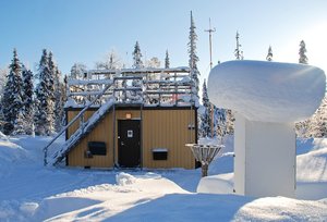
Oulanka Research Station operates and offers access to visitors throughout the year. The station is a primary location for field courses at Oulu University (especially biology and geography) with 5-8 different courses and roughly 1500 person-days per year. The station lies in the heart of the Oulanka National Park at an optimal distance to various field research locations. Being a multi-disciplinary research station, Oulanka is open to almost all kinds of research activities. The station has 82 beds, two well-equipped laboratories, an auditorium, classrooms, workshops, and high-speed internet.

History and facilities

Oulanka National Park is a northern biodiversity hot-spot, thanks to the calcium-rich bedrock, varying topography, and large environmental gradients within a small area. Moreover, it has historically been at the cross-roads for movement of northern, southern and eastern species. Unlike most of Finland, the local rivers drain towards the northeast, i.e. to the White Sea.

General research and databases

The study area includes the towns of Kuusamo, Posio, Taivalkoski, and Salla and covers an area of roughly 100 &times; 200 km. Most of the research activity is concentrated in and around the Oulanka National Park. Historically research has been focused on animal and plant ecology as well as geography. Recently sociological aspects have been included as well. Oulanka has a broad range of long-term data series available for researchers. These include both biological and physical/chemical datasets, and many of them have been collected since 1966. The datasets cover time-series on meteorology, water chemistry of streams and lakes, phenology, ice cover, snow cover, active layer depth, air pollution, as well as different plant and animal species, etc. Oulanka also offers a recently acquired, extremely comprehensive (70 &times; 90 km) set of high-resolution aerial photographs covering three different areas, i.e. the early 1950&rsquo;s, the early 1980&rsquo;s, and c. 2005.

Link to data: https://dataportal.eu-interact.org/stations

Station Monitoring

Human dimension

The nearest village with stores and services is 13 km away, while the ski centre of Ruka is 30 km away. Outside the villages and towns, the area is sparsely populated, but tourism is an important activity with associated impacts on nature. In addition to tourism, forestry, and mining are the other major human impacts in the area.

Access

Oulanka Research Station can be reached by car, by bus, or by plane to Kuusamo (55 km from the station) year-round.

Member of: